
See how our solutions and technology can fast-track your productivity and profits.
Next-generation photogrammetry software for terrestrial, corridor and large scale mapping
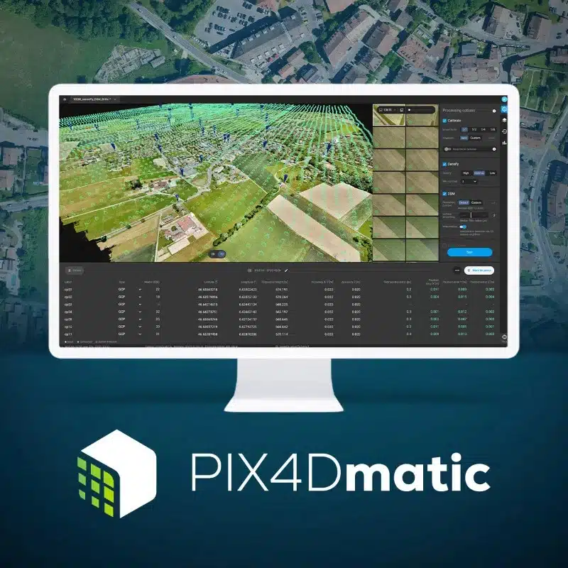
Pix4Dmatic processes thousands of images while maintaining survey-grade accuracy. With Pix4Dmatic, you can import, process and assess the quality of a project in just a few clicks. Get your results up to 50% faster, enjoy easy accuracy checks and seamlessly import from Pix4DCatch. Additionally, move easily from Pix4Dmatic to Pix4Survey with direct export. Generate a dense point cloud, digital representation of all objects in the mapped area, a 3D textured mesh, orthomosaics that are geometrically corrected and more.