


See how our solutions and technology can fast-track your productivity and profits.
4/3 CMOS, 20MP Effective Pixels, f/2.8-f/11, Format Equivalent: 24 mm, Mechanical Shutter
1/1.3″ CMOS, 48MP Effective Pixels, f/2.8, Format Equivalent: 70 mm
1/1.5″ CMOS, 48MP Effective Pixels, f/2.8, Format Equivalent: 168 mm
Measurement Range: 1800 m (1 Hz); Oblique Incidence Range (1:5
Oblique Distance): 600 m (1 Hz) Blind Zone: 1 m; Range Accuracy (m): + (0.2 + 0.0015 × D) [1]
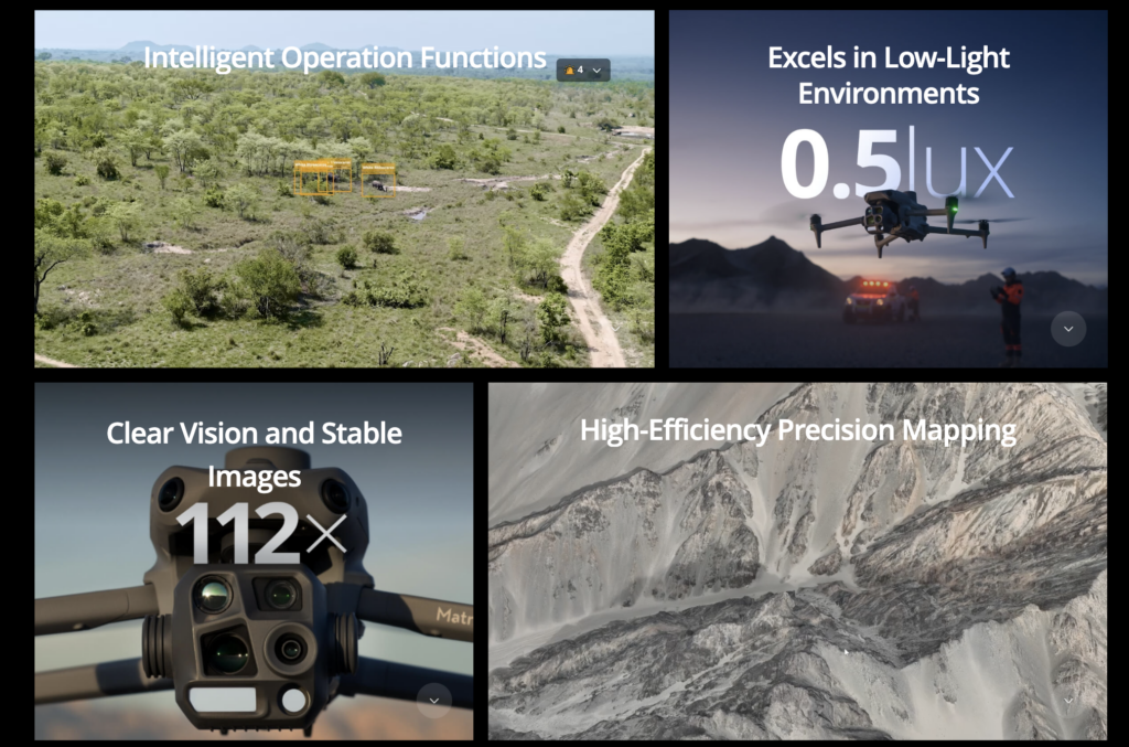
The built-in model can detect vehicles, vessels, and subjects during search and rescue operations or routine flights. It also supports switching to other models, enabling the expansion of application scenarios. Additionally, it supports high-res grid photos and features powerful tracking capabilities.
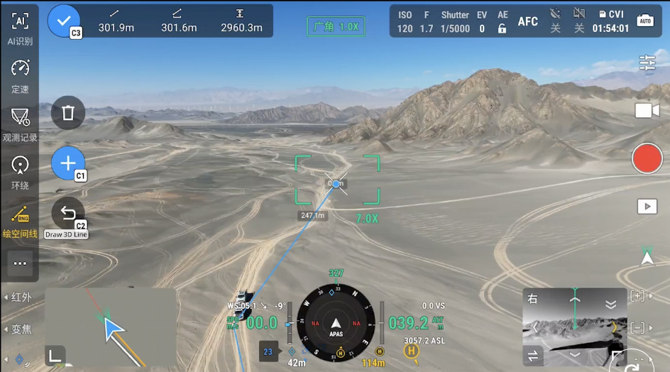
The laser range finder enables real-time precise measurement. Through simple operations such as pin point, line drawing, and area calculation, it can complete tasks like marking target locations for inspection purposes or calculating the area of a wildfire. Additionally, users can share info via the DJI Pilot QR code or FlightHub 2 with relevant personnel to enhance collaboration and workflow efficiency.
DJI Pilot 2 can highlight the center position of the camera frame and ground area observed. It can display the surveyed area on the map, making it especially useful for patrols, and rescue operations in mountainous terrain without clear landmarks.