


See how our solutions and technology can fast-track your productivity and profits.
Swappable sensors for high-quality capture across a wide range of survey tasks.
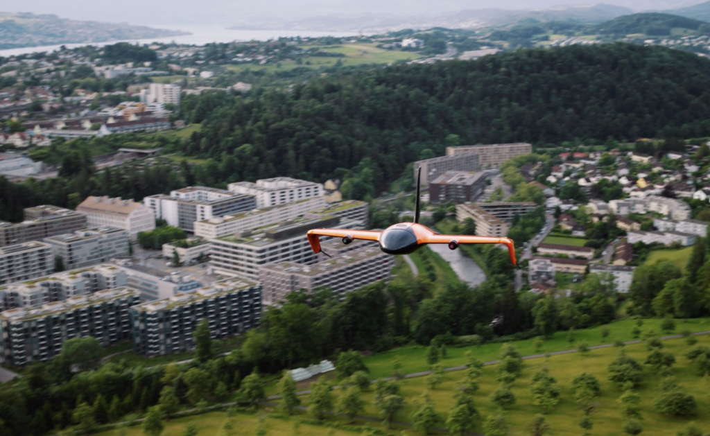
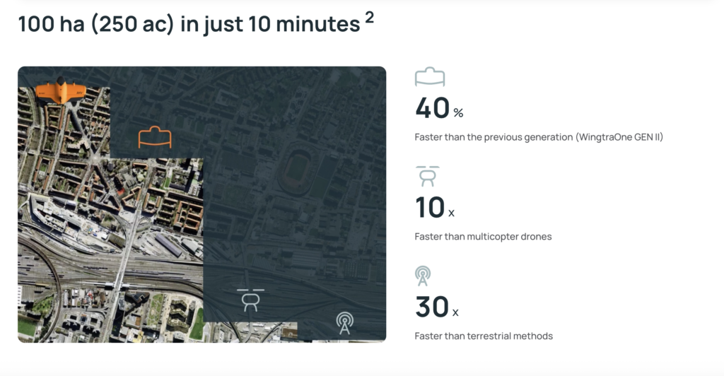
WingtraRAY flies at up to 22 m/s, so you can cover small or large areas faster-even when time is tight.
The 61 MP full-frame sensor delivers more detail with less overlap-so you complete projects in fewer flights.
Adaptive speed automatically adjusts the drone’s pace based on your output needs, maximizing coverage on every flight.
Unpack, power on, follow the interactive checklist, and launch-no calibration needed, not even for LIDAR.
Swap batteries and sensors-from RGB to LIDAR or multispectral-and get back in the air fast. No cables, no tools.